Isisford, Queensland
Page Module:Side box/styles.css has no content.
Page Template:Infobox Australian place/styles.css has no content.Script error: No such module "Template wrapper".Script error: No such module "Check for conflicting parameters". Isisford is a rural town and locality in the Longreach Region, Queensland, Australia.[2][3] In the 2021 census, the locality of Isisford had a population of 218 people.[1]
Geography
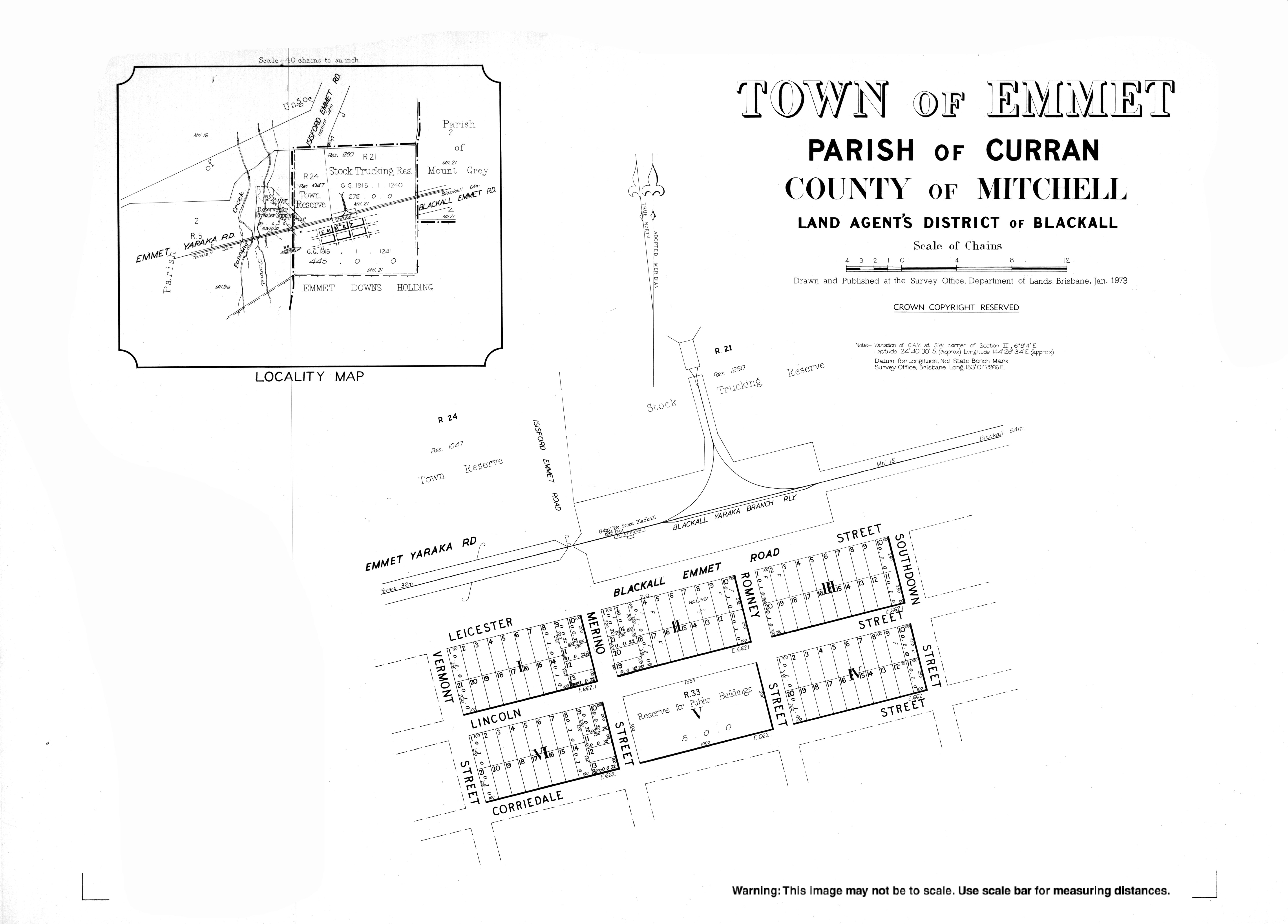
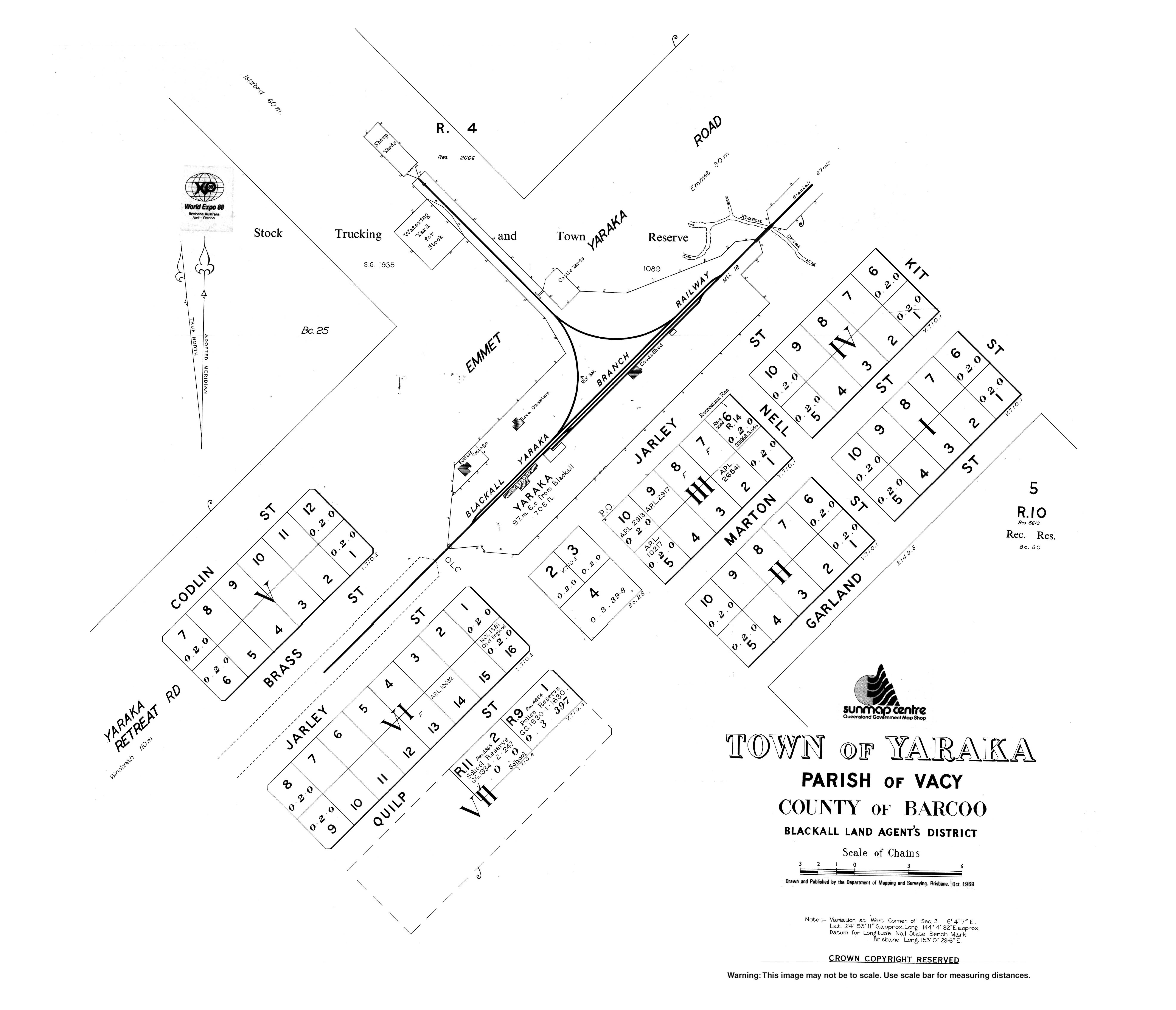
Isisford is situated in Central Western Queensland on the Barcoo River, and is approximately 120 kilometres (75 mi) south east of the town of Longreach. The town of Emmet (Lua error: callParserFunction: function "#coordinates" was not found.) is located 50 kilometres (31 mi) south of Isisford,[4][5] and Yaraka (Lua error: callParserFunction: function "#coordinates" was not found.) is located 102 kilometres (63 mi) to the south-west.[6][7] Isisford–Blackall Road runs east from the town to the locality of Blackall.[8]
Idalia National Park and Welford National Park are accessible from the town.
The following hills are near Isisford:
- Double Top (Lua error: callParserFunction: function "#coordinates" was not found.) 469 metres (1,539 ft)[9][10]
- Mount Aaron (Lua error: callParserFunction: function "#coordinates" was not found.) 334 metres (1,096 ft)[9][11]
- Mount Ellen (Lua error: callParserFunction: function "#coordinates" was not found.) 427 metres (1,401 ft)[9][12]
- Mount Grey (Lua error: callParserFunction: function "#coordinates" was not found.) 426 metres (1,398 ft)[9]
- Mount Malcolm (Lua error: callParserFunction: function "#coordinates" was not found.)[9][13]
- Mount Mingera (Lua error: callParserFunction: function "#coordinates" was not found.) 219 metres (719 ft)[9]
- Mount Misery (Lua error: callParserFunction: function "#coordinates" was not found.) 236 metres (774 ft)[9][14]
- Mount Moses (Lua error: callParserFunction: function "#coordinates" was not found.)[9][15]
- Mount Perrier (Lua error: callParserFunction: function "#coordinates" was not found.) 337 metres (1,106 ft)[9][16]
- Mount Slowcan (Lua error: callParserFunction: function "#coordinates" was not found.)[9][17]
- Mountain Black (Lua error: callParserFunction: function "#coordinates" was not found.)[9][18]
- Observatory Hill (Lua error: callParserFunction: function "#coordinates" was not found.)[9][19]
- Opal Hill (Lua error: callParserFunction: function "#coordinates" was not found.) 301 metres (988 ft)[9][20]
- Penny Knob (Lua error: callParserFunction: function "#coordinates" was not found.) 391 metres (1,283 ft)[9][21]
- The Sisters (Lua error: callParserFunction: function "#coordinates" was not found.)[9][22]
- Yellow Mountain (Lua error: callParserFunction: function "#coordinates" was not found.) 330 metres (1,080 ft)[9][23]
Climate
Script error: No such module "weather box".
History

The Indigenous people of the Isisford region are known as the Kuungkari people.[26] The first Europeans to enter the area were members of the expedition led by Thomas Mitchell, who journeyed through what is now Isisford in September 1846. Mitchell described a large native encampment being present with permanent huts and well-beaten pathways. The resident people were alarmed at the arrival of this group, and Mitchell continued through with little interaction. He made camp at a nearby lagoon, which he called Yuranigh's Pond, after Yuranigh, his Wiradjuri guide.[27]
In 1847, Edmund Kennedy's exploratory group travelled through the region where he obtained the name of the Barcoo River from an old Kuungkari man living near Yuranigh's Pond.[28] The expedition of Augustus Charles Gregory passed through the same area in 1858. While they were encamped, they fired a shot into the scrub to scare away the local Aborigines.[29] In 1862, the expedition led by William Landsborough camped close to the same place and likewise felt threatened by the resident Kuungkari. A number armed with clubs and throwing sticks approached the camp and Landsborough ordered his men to fire. One Kuungkari man was shot dead and another wounded.[30]

British pastoralists began to enter the region in 1866 with John Charles Ellis and his brother Evelyn taking up land. They were sons of Charles Ellis, 6th Baron Howard de Walden and named their property Portland Downs after their maternal grandfather William Bentinck, 4th Duke of Portland. A year later, Charles Lumley Hill established the neighbouring Isis Downs property and John Fanning formed Ruthven.[31][32][33] Frontier violence ensued with Fanning being killed in 1868 by resident Aboriginal men and another squatter named Richard Welford being killed in 1872. Punitive expeditions conducted by Native Police and local pastoralists such Charles Lumley Hill subsequently occurred, with many Indigenous people being shot.[34][35][32][36]
.jpg)
In May 1875, closer development started to occur with James Whitman opening a hotel, store and blacksmith.[37] Land for the township of Whittington was reserved in 1877, and the town was surveyed as the Town of Wittown in April 1878; it is said that Whitman named it after himself.[38][39][40]
Isis Downs Post Office opened on 1 June 1868 and was replaced by the Wittown office in 1876. However, in May 1878, the name Isisford was proposed and by August 1878 it had been renamed Isisford, because it was near the Isis Downs pastoral run and a ford on the Barcoo River.[41][42][43][44][45][46] In the following years the town progressed with the growth of the pastoral industry.[42] A post office and telegraph line were operating by 1881.[42]
Isisford Private School opened in the 1870s. It was by operated by Mr R Venables. It closed when Isisford Provisional School opened on 19 October 1881 with Venables becoming its first teacher. Circa 1883 the provisional school became Isisford State School. In 1892 it became Isisford Provisional School, returning to state school status in January 1894.[47][48]

The Queensland Government called for tenders to build a court house in Isisford in August 1883 with the contract awarded to William McLaughlin in November 1883.[49][50] The court house was completed in November 1885.[51]
In April 1910, Isisford became the first town in Australia to be serviced by a motorised mail delivery (from Ilfracombe, 90 kilometres (56 mi) to the north).[52] A plaque on the post office commemorates the centenary of the commencement of the service.
Isisford Convent School was established in 1950 by the Presentation Sisters. It closed in 1970.[47]
In September 1956, a deliberately lit fire at the Isisford Hotel resulted in the deaths of a mother and her child.[53]
In the mid-1990s, the first fossils of Isisfordia, an extinct genus of crocodile-like animals, was discovered in a dry creek close to the town.[54] The discovery was made by the town's former Deputy Mayor, Ian Duncan, after which the new species was named.[55]
On 10 September 2021, a new locality called Yaraka was created around the town of Yaraka, the land being excised from the locality of Isisford, to avoid confusion and restore historical connections.[56][57][58]
Demographics
In the 2011 census, the locality of Isisford and the surrounding area had a population of 262.[59] This figure has never surpassed 300.[42]
In the 2016 census, the locality of Isisford had a population of 218 people.[60]
In the 2021 census, the locality of Isisford had a population of 218 people.[1]
Heritage listings
Isisford has a number of heritage-listed sites, including:
- Old Isisford District Hospital, 6 St Agnes Street[61]
- Isis Downs Woolshed, Isisford-Blackall Road[62]
Education
Isisford State School is a government primary (Prep-6) school for boys and girls at 14 St Helena Street (Lua error: callParserFunction: function "#coordinates" was not found.).[63][64] In 2018, the school had an enrolment of 9 students with 2 teachers and 4 non-teaching staff (2 full-time equivalent).[65]
There is no secondary school in Isisford. The nearest government secondary schools are in Longreach and Blackall but are sufficiently distant that distance education and boarding school would be alternatives.[66]
Amenities
Isisford has a public library at 20 St Mary Street operated by the Longreach Regional Council.[67]
It also has a swimming pool and visitor information centre.
References
Page Template:Reflist/styles.css has no content.
- ^ a b c Template:Census 2021 AUS
- ^ Page Module:Citation/CS1/styles.css has no content."Isisford – town in Longreach Region (entry 44229)". Queensland Place Names. Queensland Government. Retrieved 27 December 2020.
- ^ Page Module:Citation/CS1/styles.css has no content."Isisford – locality in Longreach Region (entry 50310)". Queensland Place Names. Queensland Government. Retrieved 27 December 2020.
- ^ Page Module:Citation/CS1/styles.css has no content."Emmet – population centre in Longreach Regional (entry 11627)". Queensland Place Names. Queensland Government. Retrieved 18 September 2020.
- ^ Script error: No such module "Template wrapper".
- ^ Page Module:Citation/CS1/styles.css has no content."Yaraka – population centre in Longreach Regional (entry 38459)". Queensland Place Names. Queensland Government. Retrieved 18 September 2020.
- ^ Script error: No such module "Template wrapper".
- ^ Template:Google maps
- ^ a b c d e f g h i j k l m n o p Page Module:Citation/CS1/styles.css has no content."Mountain peaks and capes – Queensland". Queensland Open Data. Queensland Government. 12 November 2020. Archived from the original on 25 November 2020. Retrieved 25 November 2020.
- ^ Page Module:Citation/CS1/styles.css has no content."Double Top – mountain in Longreach Region (entry 10425)". Queensland Place Names. Queensland Government. Retrieved 25 November 2020.
- ^ Page Module:Citation/CS1/styles.css has no content."Mount Aaron – mountain in Longreach Region (entry 5)". Queensland Place Names. Queensland Government. Retrieved 25 November 2020.
- ^ Page Module:Citation/CS1/styles.css has no content."Mount Ellen – mountain in Longreach Region (entry 11527)". Queensland Place Names. Queensland Government. Retrieved 25 November 2020.
- ^ Page Module:Citation/CS1/styles.css has no content."Mount Malcolm – mountain in Longreach Region (entry 20706)". Queensland Place Names. Queensland Government. Retrieved 25 November 2020.
- ^ Page Module:Citation/CS1/styles.css has no content."Mount Misery – mountain in Longreach Region (entry 22296)". Queensland Place Names. Queensland Government. Retrieved 25 November 2020.
- ^ Page Module:Citation/CS1/styles.css has no content."Mount Moses – mountain in Longreach Region (entry 22890)". Queensland Place Names. Queensland Government. Retrieved 25 November 2020.
- ^ Page Module:Citation/CS1/styles.css has no content."Mount Perrier – mountain in Longreach Region (entry 26468)". Queensland Place Names. Queensland Government. Retrieved 25 November 2020.
- ^ Page Module:Citation/CS1/styles.css has no content."Mount Slowcan – mountain in Longreach Region (entry 31181)". Queensland Place Names. Queensland Government. Retrieved 25 November 2020.
- ^ Page Module:Citation/CS1/styles.css has no content."Mountain Black – mountain in Longreach Region (entry 2966)". Queensland Place Names. Queensland Government. Retrieved 25 November 2020.
- ^ Page Module:Citation/CS1/styles.css has no content."Observatory Hill – mountain in Longreach Region (entry 25215)". Queensland Place Names. Queensland Government. Retrieved 25 November 2020.
- ^ Page Module:Citation/CS1/styles.css has no content."Opal Hill – mountain in Longreach Region (entry 25511)". Queensland Place Names. Queensland Government. Retrieved 25 November 2020.
- ^ Page Module:Citation/CS1/styles.css has no content."Penny Knob – mountain in Longreach Region (entry 26398)". Queensland Place Names. Queensland Government. Retrieved 25 November 2020.
- ^ Page Module:Citation/CS1/styles.css has no content."The Sisters – mountain in Longreach Region (entry 34118)". Queensland Place Names. Queensland Government. Retrieved 25 November 2020.
- ^ Page Module:Citation/CS1/styles.css has no content."Yellow Mountain – mountain in Longreach Region (entry 38617)". Queensland Place Names. Queensland Government. Retrieved 25 November 2020.
- ^ Page Module:Citation/CS1/styles.css has no content."Isisford Post Office Climate Normals for 1991-2020" (CSV). National Oceanic and Atmospheric Administration. Retrieved 4 August 2024.
- ^ Page Module:Citation/CS1/styles.css has no content."Climate statistics for Australian locations". Bureau of Meteorology. Retrieved 3 August 2024.
- ^ Page Module:Citation/CS1/styles.css has no content.Tindale, Norman Barnett (1974). "Kunggari (QLD)". Aboriginal Tribes of Australia: Their Terrain, Environmental Controls, Distribution, Limits, and Proper Names. Australian National University. ISBN 978-0-708-10741-6.
- ^ Page Module:Citation/CS1/styles.css has no content.Mitchell, Thomas (1848). Journal of an Expedition into the Interior of Tropical Australia. Archived from the original on 8 December 2023. Retrieved 30 May 2023 – via Project Gutenberg.
- ^ Page Module:Citation/CS1/styles.css has no content.Beale, Edgar (1983). Kennedy, The Barcoo and Beyond, 1847. Hobart: Blubber Head Press. ISBN 0908528116.
- ^ Page Module:Citation/CS1/styles.css has no content.Gregory, Augustus Charles; Gregory, Francis Thomas (1884). Journals of Australian Explorations. Brisbane: Beal Publishing. Archived from the original on 31 May 2023. Retrieved 31 May 2023.
- ^ Page Module:Citation/CS1/styles.css has no content.Landsborough, William (1862). Journal of Landsborough's Expedition from Carpentaria in search of Burke and Wills. Melbourne: Bailliere Publisher. Archived from the original on 31 May 2023. Retrieved 31 May 2023.
- ^ Page Module:Citation/CS1/styles.css has no content."Isisford and Isisford Shire". queenslandplaces.com. Archived from the original on 3 June 2023. Retrieved 3 June 2023.
- ^ a b Page Module:Citation/CS1/styles.css has no content."THE EARLY DAYS". Morning Bulletin. No. 18020. Queensland, Australia. 28 October 1922. p. 11. Retrieved 3 June 2023 – via National Library of Australia.
- ^ Page Module:Citation/CS1/styles.css has no content."The Barcoo and Thomson". The Western Champion. Vol. XLVI, no. 1719. Queensland, Australia. 27 December 1924. p. 13. Retrieved 3 June 2023 – via National Library of Australia.
- ^ Page Module:Citation/CS1/styles.css has no content."Old Barcoo Days". The World's News. No. 245. New South Wales, Australia. 25 August 1906. p. 10. Retrieved 3 June 2023 – via National Library of Australia.
- ^ Page Module:Citation/CS1/styles.css has no content."Death of Mr. Lumley Hill". The Beaudesert Times. Vol. 2, no. 56. Queensland, Australia. 5 November 1909. p. 3. Retrieved 3 June 2023 – via National Library of Australia.
- ^ Page Module:Citation/CS1/styles.css has no content.Rayment, Bertie James (1970). My Towri. Jundah: Tabra Press.
- ^ Page Module:Citation/CS1/styles.css has no content."TAMBO". Western Star And Roma Advertiser. Vol. I, no. 9. Queensland, Australia. 22 May 1875. p. 3. Archived from the original on 22 December 2020. Retrieved 22 October 2017 – via National Library of Australia.
- ^ Page Module:Citation/CS1/styles.css has no content."The Sketcher". The Queenslander. Vol. XII, no. 121. Queensland, Australia. 8 December 1877. p. 14. Archived from the original on 22 December 2020. Retrieved 22 October 2017 – via National Library of Australia.
- ^ Page Module:Citation/CS1/styles.css has no content."Official Notifications". Maryborough Chronicle, Wide Bay and Burnett Advertiser. No. 2054. Queensland, Australia. 18 October 1877. p. 2. Retrieved 30 November 2024 – via National Library of Australia.
- ^ Page Module:Citation/CS1/styles.css has no content."Thornhill v. Transatlantic Fire Insurance Company". The Brisbane Courier. Vol. XXXII, no. 3, 432. Queensland, Australia. 18 May 1878. p. 5. Retrieved 30 November 2024 – via National Library of Australia.
- ^ Page Module:Citation/CS1/styles.css has no content."Isisford – town (entry 44229)". Queensland Place Names. Queensland Government. Retrieved 31 August 2015.
- ^ a b c d Page Module:Citation/CS1/styles.css has no content.Environmental Protection Agency (Queensland) (2002). Heritage Trails of the Queensland Outback. State of Queensland. pp. 159–160. ISBN 0-7345-1040-3.
- ^ Page Module:Citation/CS1/styles.css has no content."Country News". The Queenslander. Vol. XIV, no. 142. Queensland, Australia. 4 May 1878. p. 134. Retrieved 22 October 2017 – via National Library of Australia.
- ^ Page Module:Citation/CS1/styles.css has no content."COLONIAL". The Daily Northern Argus. No. 2869. Queensland, Australia. 22 August 1878. p. 2. Retrieved 22 October 2017 – via National Library of Australia.
- ^ Page Module:Citation/CS1/styles.css has no content.Premier Postal History. "Post Office List". Premier Postal Auctions. Archived from the original on 15 May 2014. Retrieved 10 May 2014.
- ^ Page Module:Citation/CS1/styles.css has no content."Current News". The Queenslander. Vol. XI, no. 69. Queensland, Australia. 9 December 1876. p. 8. Retrieved 2 February 2023 – via National Library of Australia.
- ^ a b Page Module:Citation/CS1/styles.css has no content.Queensland Family History Society (2010), Queensland schools past and present (Version 1.01 ed.), Queensland Family History Society, ISBN 978-1-921171-26-0
- ^ Page Module:Citation/CS1/styles.css has no content."Opening and closing dates of Queensland Schools". Queensland Government. Retrieved 18 April 2019.
- ^ Page Module:Citation/CS1/styles.css has no content."PUBLIC WORKS". The Queenslander. Vol. XXIV, no. 411. Queensland, Australia. 11 August 1883. p. 19. Archived from the original on 22 December 2020. Retrieved 22 October 2017 – via National Library of Australia.
- ^ Page Module:Citation/CS1/styles.css has no content."Official Notifications". The Queenslander. Vol. XXIV, no. 423. Queensland, Australia. 3 November 1883. p. 734. Archived from the original on 22 December 2020. Retrieved 22 October 2017 – via National Library of Australia.
- ^ Page Module:Citation/CS1/styles.css has no content."COUNTRY NEWS". The Western Champion. Vol. VII, no. 336. Queensland, Australia. 19 November 1885. p. 4. Archived from the original on 22 December 2020. Retrieved 22 October 2017 – via National Library of Australia.
- ^ Page Module:Citation/CS1/styles.css has no content.Arthur, Chrissy (1 April 2010). "Outback towns deliver mail milestone celebration". Australia: ABC News. Archived from the original on 30 October 2016. Retrieved 5 October 2019.
- ^ Page Module:Citation/CS1/styles.css has no content.McKay, Mark (1999). On Tap: A Cavalcade of Trivia and Tall Stories Celebrating 200 Years of the Australian Pub. Wakefield Press. p. 87. ISBN 1862544735. Retrieved 11 July 2013.
- ^ Page Module:Citation/CS1/styles.css has no content."Ancestor of all modern crocodilians discovered in outback Queensland". The University of Queensland. 14 June 2006. Archived from the original on 21 September 2013. Retrieved 11 July 2013.
- ^ Page Module:Citation/CS1/styles.css has no content."Missing link crocodile found down under". Science Buzz. Science Museum of Minnesota. 18 June 2006. Archived from the original on 21 September 2013. Retrieved 11 July 2013.
- ^ Page Module:Citation/CS1/styles.css has no content."Recent place name decisions: Job number 19-027: Yaraka". Queensland Government. 10 September 2021. Archived from the original on 28 July 2019. Retrieved 7 February 2022.
- ^ Page Module:Citation/CS1/styles.css has no content."Proposed Locality Names and Boundaries: Isisford and Yaraka" (PDF). Queensland Government. 14 May 2021. Archived (PDF) from the original on 16 July 2021. Retrieved 7 February 2022.
- ^ Page Module:Citation/CS1/styles.css has no content."Locality Boundaries of Isisford and Yaraka" (PDF). Queensland Government. 10 September 2021. Archived (PDF) from the original on 7 February 2022. Retrieved 7 February 2022.
- ^ Page Module:Citation/CS1/styles.css has no content.Australian Bureau of Statistics (31 October 2012). "Isisford (State Suburb)". 2011 Census QuickStats. Retrieved 11 July 2013.Script error: No such module "EditAtWikidata".Template:WikidataCheck
- ^ Template:Census 2016 AUS
- ^ Page Module:Citation/CS1/styles.css has no content."Isisford District Hospital (former) (entry 602837)". Queensland Heritage Register. Queensland Heritage Council. Retrieved 17 December 2017.
- ^ Page Module:Citation/CS1/styles.css has no content."Isis Downs Woolshed Complex (entry 602544)". Queensland Heritage Register. Queensland Heritage Council. Retrieved 10 July 2013.
- ^ Page Module:Citation/CS1/styles.css has no content."State and non-state school details". Queensland Government. 9 July 2018. Archived from the original on 21 November 2018. Retrieved 21 November 2018.
- ^ Page Module:Citation/CS1/styles.css has no content."Isisford State School". Archived from the original on 24 March 2020. Retrieved 21 November 2018.
- ^ Page Module:Citation/CS1/styles.css has no content."ACARA School Profile 2018". Australian Curriculum, Assessment and Reporting Authority. Archived from the original on 27 August 2020. Retrieved 28 January 2020.
- ^ Template:Queensland Globe
- ^ Page Module:Citation/CS1/styles.css has no content."Isisford Library". State Library of Queensland. State Library of Queensland. Archived from the original on 10 February 2019. Retrieved 22 January 2018.
External links
Page Module:Side box/styles.css has no content.Page Template:Sister project/styles.css has no content.
- Page Module:Citation/CS1/styles.css has no content."Town of Isisford" (Map). Queensland Government. 1979.
- Page Module:Citation/CS1/styles.css has no content."Town of Emmet" (Map). Queensland Government. 1973.
- Page Module:Citation/CS1/styles.css has no content."Town of Yaraka" (Map). Queensland Government. 1969.
Lua error in package.lua at line 80: module 'Module:Navbox/configuration' not found.
Lua error in package.lua at line 80: module 'Module:Authority control/config' not found.