Inkerman, Queensland
Template:Short description Template:DMCA Template:DMCA
Page Module:Side box/styles.css has no content.
Page Template:Infobox Australian place/styles.css has no content.Script error: No such module "Template wrapper".Script error: No such module "Check for conflicting parameters". Inkerman is a rural town and locality in the Shire of Burdekin, Queensland, Australia.[2][3] In the 2021 census, the locality of Inkerman had a population of 119 people.[1]
Geography
Inkerman is bounded to the west by the Bruce Highway and the North Coast railway line.[4]
Although most of the locality is flat land (0-10 metres (33 ft) above sea level, Inkerman has the following mountains:
- Charlies Hill (Lua error: callParserFunction: function "#coordinates" was not found.) 32 metres (105 ft)[5][6]
- Mount Alma (Lua error: callParserFunction: function "#coordinates" was not found.) 104 metres (341 ft)[5][7]
- Mount Inkerman (Lua error: callParserFunction: function "#coordinates" was not found.) 219 metres (719 ft)[5][8]
The predominant land use is growing sugarcane with some grazing on native vegetation.[4]
History
Inkerman Post Office opened by 1915 as a receiving office (known for a time as Inkerman Siding) and closed in 1975.[9]
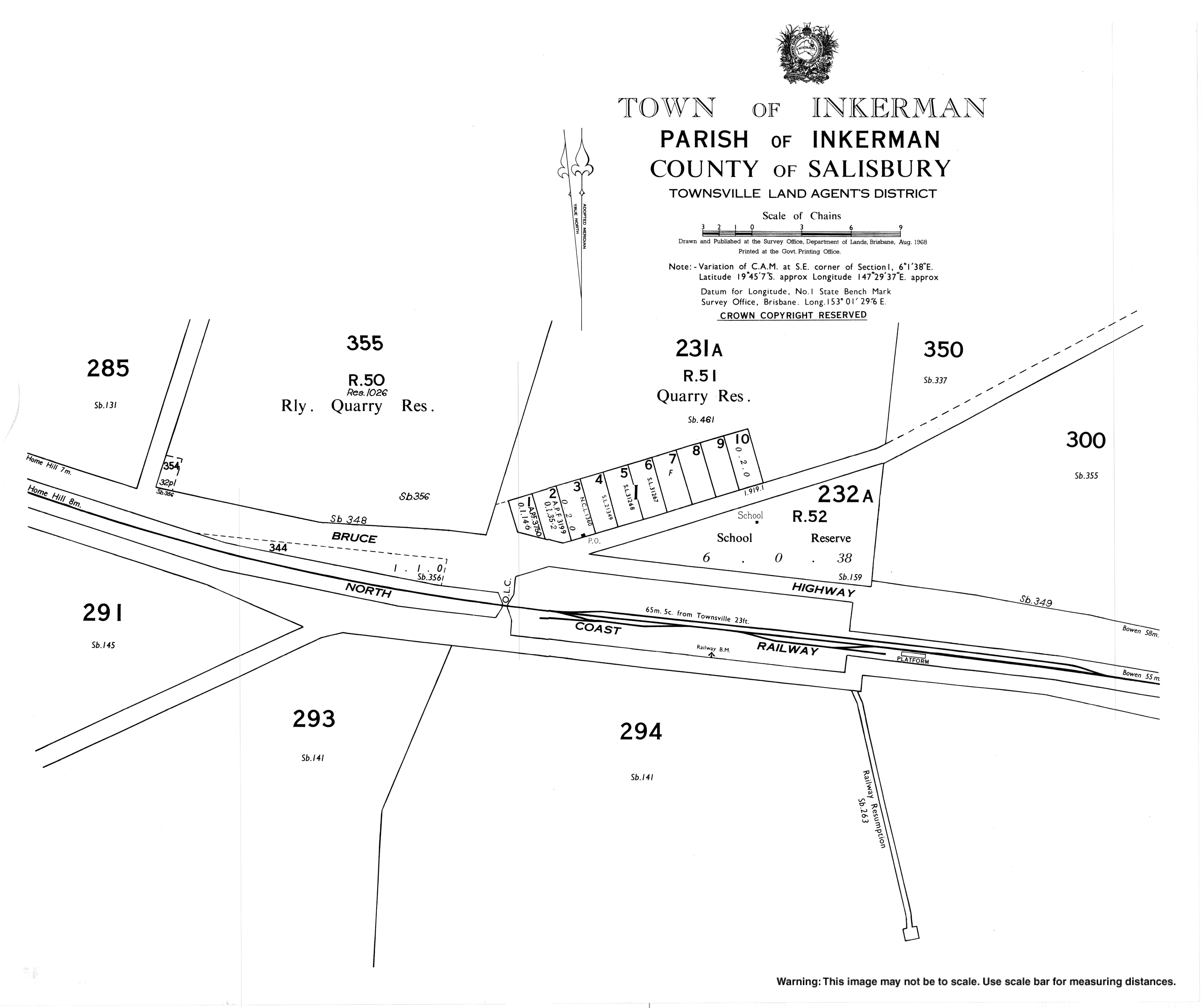
Inkerman State School opened on 24 November 1915. It closed on 31 December 1974.[10] It was at 22 Wallace Road (Lua error: callParserFunction: function "#coordinates" was not found.).[11] The school buildings were still on the site in January 2008,[12]
Demographics
In the 2016 census, the locality of Inkerman had a population of 520 people.[13]
In the 2011 census, the locality of Inkerman had a population of 364 people.[14]
In the 2016 census, the locality of Inkerman had a population of 145 people.[15]
In the 2021 census, the locality of Inkerman had a population of 119 people.[1]
Heritage listings
Inkerman has a number of heritage-listed sites, including:
- Off Charlie's Hill Road (Lua error: callParserFunction: function "#coordinates" was not found.): Radar Station, Charlie's Hill[16]
Education
There are no schools in Inkerman. The nearest government schools are Home Hill State School (primary) and Home Hill State High School (secondary), both in neighbouring Home Hill to the north-west.[4]
Attractions
At the top of Mount Inkerman there are views in all directions as well as picnic facilities.[17] Mount Inkerman Road goes to the top of the mountain.[18][19]
Charlies Hill also has views and the remains of the heritage-listed radar station. Access to the top is via an unsealed road off Charlies Hill Road.[20]
References
Page Template:Reflist/styles.css has no content.
- ^ a b c Template:Census 2021 AUS
- ^ Page Module:Citation/CS1/styles.css has no content."Inkerman – town in Shire of Burdekin (entry 16707)". Queensland Place Names. Queensland Government. Retrieved 26 December 2020.
- ^ Page Module:Citation/CS1/styles.css has no content."Inkerman – locality in Shire of Burdekin (entry 49586)". Queensland Place Names. Queensland Government. Retrieved 26 December 2020.
- ^ a b c Template:Queensland Globe
- ^ a b c Page Module:Citation/CS1/styles.css has no content."Mountain peaks and capes - Queensland". Queensland Open Data. Queensland Government. 12 November 2020. Archived from the original on 25 November 2020. Retrieved 25 November 2020.
- ^ Page Module:Citation/CS1/styles.css has no content."Charlies Hill – mountain in Burdekin Shire (entry 6923)". Queensland Place Names. Queensland Government. Retrieved 25 November 2020.
- ^ Page Module:Citation/CS1/styles.css has no content."Mount Alma – mountain in Burdekin Shire (entry 442)". Queensland Place Names. Queensland Government. Retrieved 25 November 2020.
- ^ Page Module:Citation/CS1/styles.css has no content."Mount Inkerman – mountain in Burdekin Shire (entry 16715)". Queensland Place Names. Queensland Government. Retrieved 25 November 2020.
- ^ Page Module:Citation/CS1/styles.css has no content.Premier Postal History. "Post Office List". Premier Postal Auctions. Archived from the original on 15 May 2014. Retrieved 10 May 2014.
- ^ Page Module:Citation/CS1/styles.css has no content."Opening and closing dates of Queensland Schools". Queensland Government. Retrieved 14 January 2016.
- ^ Page Module:Citation/CS1/styles.css has no content."Town of Inkerman" (Map). Queensland Government. 1968. Archived from the original on 18 February 2021. Retrieved 19 February 2021.
- ^ Template:Google maps
- ^ Page Module:Citation/CS1/styles.css has no content.Australian Bureau of Statistics (25 October 2007). "Inkerman (Burdekin Shire) (State Suburb)". 2006 Census QuickStats. Retrieved 29 May 2011.
- ^ Page Module:Citation/CS1/styles.css has no content.Australian Bureau of Statistics (31 October 2012). "Inkerman". 2011 Census QuickStats. Retrieved 14 January 2016.Script error: No such module "EditAtWikidata".Template:WikidataCheck
- ^ Template:Census 2016 AUS
- ^ Page Module:Citation/CS1/styles.css has no content."Radar Station, Charlie's Hill (entry 601716)". Queensland Heritage Register. Queensland Heritage Council. Retrieved 7 July 2013.
- ^ Template:Google maps
- ^ Page Module:Citation/CS1/styles.css has no content."Inkerman Hill". www.queensland.com. Archived from the original on 4 December 2020. Retrieved 20 February 2021.
- ^ Page Module:Citation/CS1/styles.css has no content."Mt Inkerman lookout to get a facelift". Burdekin Shire Council. Retrieved 14 January 2016.[permanent dead link]
- ^ Page Module:Citation/CS1/styles.css has no content."Charlie's Hill". Tourism and Events Queensland. Retrieved 20 February 2021.
External links
Page Module:Side box/styles.css has no content.Page Template:Sister project/styles.css has no content.
- Page Module:Citation/CS1/styles.css has no content."Inkerman". Queensland Places. Centre for the Government of Queensland, University of Queensland.
- Page Module:Citation/CS1/styles.css has no content."Town map of Inkerman". Queensland Government. 1968.
Lua error in package.lua at line 80: module 'Module:Authority control/config' not found.