California State Route 71
Template:Short description Template:DMCA Template:DMCA
Page Template:Hlist/styles.css has no content.Page Template:Plainlist/styles.css has no content.Page Module:Infobox/styles.css has no content.Page Template:Infobox road/styles.css has no content.
| Script error: No such module "Infobox road/route". | |
|---|---|
| Lua error in package.lua at line 80: module 'Module:Road data/util' not found. | |
SR 71 highlighted in red | |
| Script error: No such module "Infobox mapframe". | |
| Lua error in package.lua at line 80: module 'Module:Road data/util' not found. | |
| Lua error in package.lua at line 80: module 'Module:Road data/util' not found. | |
| Lua error in package.lua at line 80: module 'Module:Road data/util' not found. | |
| Lua error in package.lua at line 80: module 'Module:Road data/util' not found. | |
| Length | Lua error: expandTemplate: template "cvt" does not exist. |
| Existed | Lua error in package.lua at line 80: module 'Module:Road data/util' not found. |
| Lua error in package.lua at line 80: module 'Module:Road data/util' not found. | |
| Page Template:Plainlist/styles.css has no content.Page Module:Infobox/styles.css has no content.Major junctions | |
| South end | Template:Jct in Corona |
| Page Template:Plainlist/styles.css has no content. | |
| North end | Template:Jct in San Dimas |
| Lua error: expandTemplate: template "Country name" does not exist. | |
| Lua error in package.lua at line 80: module 'Module:Road data/util' not found. | |
| Script error: No such module "Infobox road/browselinks". | |
| Lua error in package.lua at line 80: module 'Module:Road data/util' not found. | |
| Lua error in package.lua at line 80: module 'Module:Road data/util' not found. | |
Script error: No such module "Infobox road/errors".[[Category:Infobox road instances Template:Infobox road/meta/mask/category]]
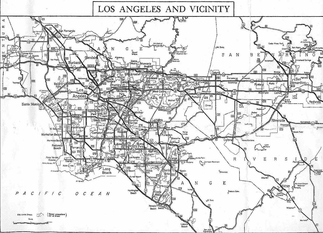
State Route 71 (SR 71) is a 15-mile (24 km) state highway in the U.S. state of California. Serving Riverside, San Bernardino, and Los Angeles counties, it runs from SR 91 in Corona to the Kellogg Interchange with I-10 and SR 57 on the border of Pomona and San Dimas. The segment from SR 91 to SR 83 in Chino Hills is called the Corona Freeway, formerly the Corona Expressway and before then the Temescal Freeway. SR 71 is designated as the Chino Valley Freeway between SR 83 and the Kellogg Interchange.
Route description
Beginning at its southern terminus, SR 91 in Corona, SR 71 is an expressway for a half-mile when it intersects with Pomona Rincon Road. After this intersection, SR 71 becomes a freeway up to Rio Rancho Road in Pomona. Construction is ongoing on the segment between Rio Rancho Road and Mission Boulevard in Pomona to upgrade it from an expressway to freeway. Page Template:Crossreference/styles.css has no content.Page Module:Hatnote/styles.css has no content. The route then resumes as a short freeway at Mission Boulevard for about a mile until it meets at the Kellogg Interchange in San Dimas, where it terminates at I-10 and SR 57 (previously, it was an expressway between Mission Boulevard and its northern terminus, but this segment was upgraded to a freeway in 2012).
The section of the highway between Corona and Chino is notorious for thick winter fogs at dawn and dusk, resulting in many automobile collisions when drivers fail to slow down due to reduced visibility. Residents of Los Serranos (now Chino Hills) recall being awakened by sounds of crinkling bumpers, fenders, and headlights.[citation needed]
As SR 71 serves as an important northwest-southeast corridor between the cities in the Pomona and San Gabriel valleys (eastern Los Angeles County) and the cities of western Riverside County, it is heavily traveled. It is used as an alternative to SR 57 (the Orange Freeway) situated to the west and I-15 (the Ontario Freeway) located to the east.[citation needed]
When the route runs through Chino Hills and Chino, there is a high-occupancy vehicle lane available for use; however, this carpool lane ends when the route enters Riverside County (to the south) and Los Angeles County (to the north). The route is a four-lane highway between SR 91 and Central Avenue (excluding HOV lanes), a six-lane highway (excluding HOV lanes) from Central Avenue to SR 60, and again a four-lane highway from SR 60 to I-10/SR 57.[citation needed]
SR 71 is part of the California Freeway and Expressway System,[2] and is part of the National Highway System.[3]
History
The original routing of SR 71, according to the 1934 listing, was from US 80 (now I-8), in San Diego north to US 66 (now SR 66), near Claremont via Lake Elsinore and Temecula.[4] The route between Claremont/Pomona and Lake Elsinore roughly followed the path of the Butterfield Overland Mail stagecoach line. When the portion between San Diego and Temecula was redesignated US 395, SR 71 was rerouted to run from Pomona to Aguanga. In 1973, it was cut back to its present terminus in Corona, with the portion between Corona and Temecula becoming I-15 and the portion between Temecula and Aguanga becoming SR 79 and SR 371. The early section of the Chino Valley Freeway was built in 1971 from the Kellogg Interchange to SR 60 (the Pomona Freeway). The section from SR 60 to SR 91 (the Riverside Freeway) was completed in March 1998.
In September 2008, construction began on the Mission 71 Project in Pomona. A bridge was constructed to allow Mission Boulevard to pass over SR 71, which now has entrance and exit ramps to Mission. Also, the intersection with Ninth Street was closed. The freeway was extended south to the former intersection at Ninth Street, where it resumes expressway status to the intersection with Old Pomona Road.[5] The construction project was completed in December 2011.[6]
The Riverside County Transportation Commission constructed a two-lane flyover ramp between eastbound SR 91 and northbound SR 71 to replace the previous one-lane loop ramp.[7] The flyover ramp was completed and opened to traffic on June 23, 2025.[8]
Future
The City of Pomona is currently working with Caltrans to upgrade the segment between Rio Rancho Road and Mission Boulevard from a four-lane expressway to a full eight-lane freeway.[9][10] By December 2016, all traffic signals were removed. Traffic entering and exiting the roads that lead into the nearby neighborhoods (North Ranch Road, Old Pomona Road, and Phillips Drive) may no longer enter or exit northbound due to added barriers in the highway's median. However, until 2021, southbound traffic could use these streets. (North Ranch Road, Old Pomona Road, and Phillips Drive can enter the highway via a stop sign.) These streets have been completely closed to southbound access as of 2021. Just south of the Mission Boulevard exit, all aspects of the highway, such as its alignment, lane width, pavement, barriers, and access, 'upgrade' to freeway standards. This project is expected to be fully complete by 2027.[11]
Exit list
Except where prefixed with a letter, postmiles were measured on the road as it was in 1964, based on a west-to-east alignment (including its original eastern segment that extended through Temecula and Anza), and do not necessarily reflect current mileage. R reflects a realignment in the route since then, M indicates a second realignment, L refers to an overlap due to a correction or change, and T indicates postmiles classified as temporary (Page Template:Crossreference/styles.css has no content.Page Module:Hatnote/styles.css has no content.).[12] Segments that remain unconstructed or have been relinquished to local control may be omitted. The numbers reset at county lines; the start and end postmiles in each county are given in the county column.
Script error: No such module "Jctint/USA". Script error: No such module "Jctint/USA". Script error: No such module "Jctint/USA". Script error: No such module "Jctint/USA". Script error: No such module "Jctint/USA". Script error: No such module "Jctint/USA". Script error: No such module "Jctint/USA". Script error: No such module "Jctint/USA". Script error: No such module "Jctint/USA". Script error: No such module "Jctint/USA". Script error: No such module "Jctint/USA". Script error: No such module "Jctint/USA". Script error: No such module "Jctint/USA". Script error: No such module "Jctint/USA". Script error: No such module "Jctint/USA". Script error: No such module "Jctint/USA". Script error: No such module "Jctint/USA". Script error: No such module "Jctint/USA". Script error: No such module "Jctint/USA". Script error: No such module "Jctint/USA". Script error: No such module "Jctint/USA". Script error: No such module "Jctint/USA".
| County | Location | Postmile [12][1][13] | Exit [14] | Destinations | Notes |
|---|---|---|---|---|---|
| Page Module:Jctbtm/styles.css has no content.1.000 mi = 1.609 km; 1.000 km = 0.621 mi Page Template:Hlist/styles.css has no content.
| |||||
Page Template:Reflist/styles.css has no content.
See also
- Script error: No such module "portal-inline".
- Script error: No such module "portal-inline".
References
Page Template:Reflist/styles.css has no content.
- ^ a b Page Module:Citation/CS1/styles.css has no content.California Department of Transportation (July 2007). "Log of Bridges on State Highways". Sacramento: California Department of Transportation.
- ^ Page Module:Citation/CS1/styles.css has no content."Article 2 of Chapter 2 of Division 1". California Streets and Highways Code. Sacramento: California Office of Legislative Counsel. Retrieved February 6, 2019.
- ^ Page Module:Citation/CS1/styles.css has no content.Federal Highway Administration (March 25, 2015). National Highway System: Los Angeles–Long Beach–Anaheim, CA (PDF) (Map). Scale not given. Washington, DC: Federal Highway Administration. Retrieved October 13, 2017.
- ^ Page Module:Citation/CS1/styles.css has no content."Map of 1963 routes". CA Highways. Retrieved July 27, 2008.
- ^ Page Module:Citation/CS1/styles.css has no content."Mission 71 Project". City of Pomona. Archived from the original on March 6, 2012. Retrieved June 24, 2015.
- ^ Page Module:Citation/CS1/styles.css has no content.Rodriguez, Monica (December 8, 2011). "Pomona's 71 Freeway/Mission Blvd. interchange is fully open". Inland Valley Daily Bulletin. Ontario, California. Retrieved June 24, 2015.
- ^ Page Module:Citation/CS1/styles.css has no content."71/91 Interchange Project". Riverside County Transportation Commission. Retrieved January 21, 2019.
- ^ Page Module:Citation/CS1/styles.css has no content.Ludwig, Ashley (June 23, 2025). "New RivCo Freeway Interchange Opens, Ending Lengthy $137M Project". Patch.com. Hale Media. Retrieved July 1, 2025.
- ^ Page Module:Citation/CS1/styles.css has no content.Rodriguez, Monica (January 8, 2013). "Pomona council selects option for improving 71 Freeway". Inland Valley Daily Bulletin. Ontario, California. Retrieved June 24, 2015.
- ^ Page Module:Citation/CS1/styles.css has no content."SR 71 Gap Project Highway to Freeway Conversion (I-10 to SR 60)". City of Pomona. Retrieved June 24, 2015.
- ^ Page Module:Citation/CS1/styles.css has no content."SR-71 Expressway to Freeway Conversion Project". Caltrans District 7. State of California. Retrieved September 4, 2021.
- ^ a b Page Module:Citation/CS1/styles.css has no content.California Department of Transportation. "State Truck Route List". Sacramento: California Department of Transportation. Archived from the original (XLS file) on September 5, 2015. Retrieved June 30, 2015.
- ^ California Department of Transportation, All Traffic Volumes on CSHS, 2005 and 2006
- ^ Page Module:Citation/CS1/styles.css has no content.Staff. "SR 71 Freeway Interchanges" (PDF). California Numbered Exit Uniform System. California Department of Transportation. Retrieved September 28, 2018.
External links
Script error: No such module "Attached KML".
Page Module:Side box/styles.css has no content.Page Template:Sister project/styles.css has no content.