Ivuhos
Page Module:Infobox/styles.css has no content.Page Template:Infobox islands/styles.css has no content.
Native name: Ivujos | |
|---|---|
| Lua error in package.lua at line 80: module 'Module:InfoboxImage/data' not found. | |
| Lua error in Module:Location_map at line 526: Unable to find the specified location map definition: "Module:Location map/data/Philippines Batanes" does not exist. | |
| Script error: No such module "Infobox mapframe". | |
| Geography | |
| Location | Luzon Strait |
| Coordinates | Lua error: callParserFunction: function "#coordinates" was not found. |
| Archipelago | Batanes Group of Islands |
| Adjacent to | Balintang Channel |
| Length | 4.0 km (2.49 mi) |
| Width | 1.8 km (1.12 mi) |
| Highest elevation | 90 m (300 ft)[1] |
| Administration | |
| Region | Cagayan Valley |
| Province | Batanes |
| Municipality | Sabtang |
| Demographics | |
| Population | uninhabited |
| Additional information | |
| Official website | Batanes Province Official Website |
| Template:Maplink | |
Script error: No such module "Check for conflicting parameters".
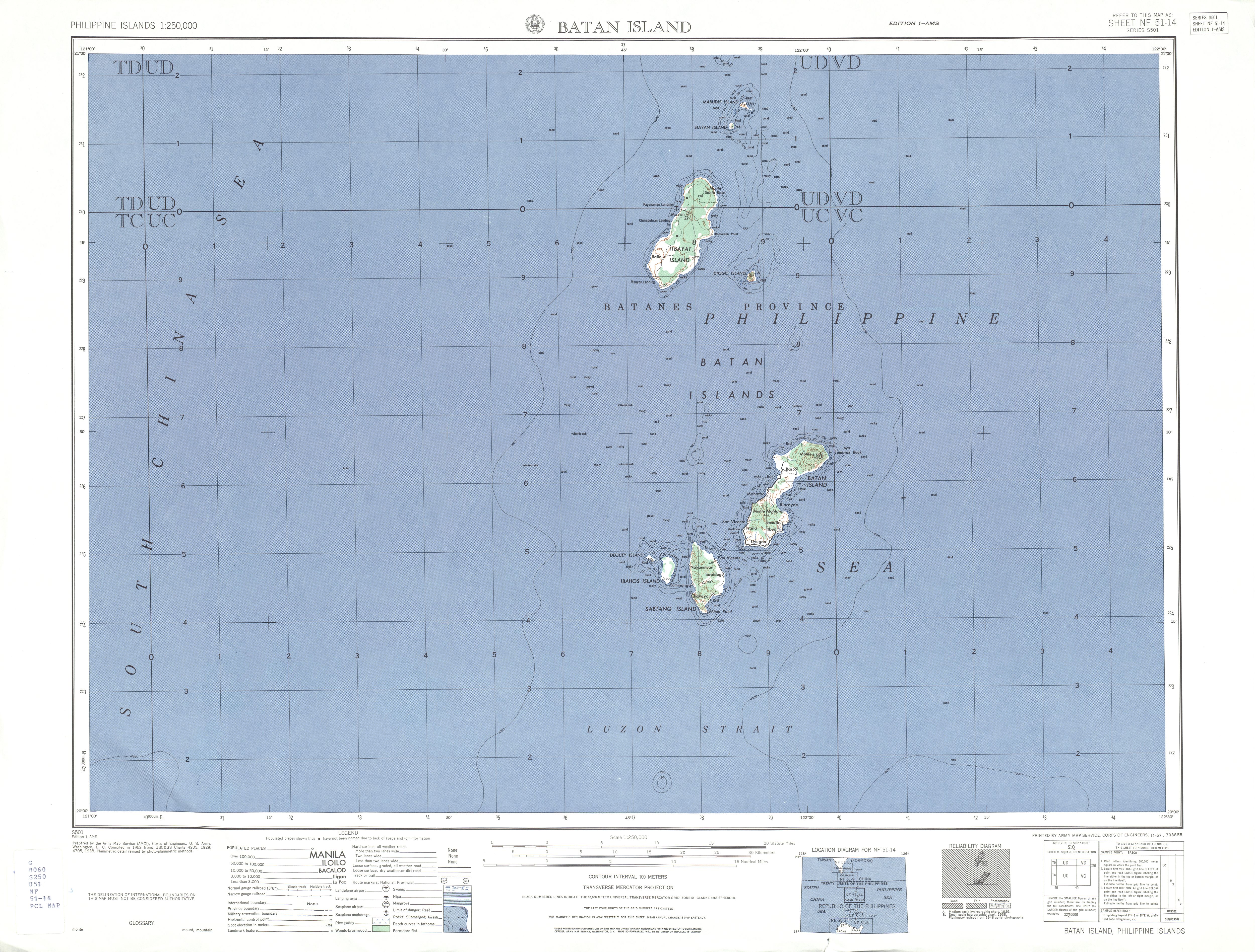
Ivuhos (also known as Ibugos,[2] Ibujos,[3] Vuhus[3] and Ibahos[1] Island) is one of the islands of Batanes, the northernmost province of the Philippines. The uninhabited island is located west of Sabtang Island and is separated by a deep channel nearly 2 kilometres (1.2 mi) wide.
Ivuhos Island is small and rather low, except a hill on the south end. A coral beach before the hill on the eastern side is the only viable landing spot on the island. The shores on both sides of the channel are bordered by reefs.[4] The flood tide sets southward with a velocity from 3 to 4 knots, and the ebb northward.
People
The island is currently uninhabited,[3] but a survey performed by the US Geodetic Service in the early 1900s found a settlement near the south end of the island.[4]
Geology
The island of Ivuhos consists entirely of coral limestone rising in steep cliffs to a height of over 60 metres (200 ft). These surround the island, except on the eastern side where the land rises gently from the fringe of sand dunes and small ponds around the shore, in contrast to the 300 metres (980 ft) agglomerate cliffs of the island of Sabtang less than 2 kilometres (1.2 mi) distant. The surface of Ibujos is gently rolling, but without any streams or definite stream valleys. This condition is partly due to the solubility of the rock which allows water to run off in underground channels, but it is also in large part an effect of the recent date of the uplift which formed the island, which has not allowed sufficient time for the streams to form valleys. The soil seems to be volcanic ash rather than limestone.[5]
The Philippine Institute of Volcanology and Seismology (PHIVOLCS) classified Ivujos Island (listed as Ibahos Island) as an inactive volcano of the Philippines.[6]
An unnamed submarine volcano is located 5 kilometres (3.1 mi) west of Ivujos, which last erupted in 1854. The seamount rises to just 24 metres (79 ft) below the water surface.[2]
See also
Lua error in mw.title.lua at line 404: bad argument #2 to 'title.new' (unrecognized namespace name 'Portal').
References
Page Template:Reflist/styles.css has no content.
- ^ a b "Batan Island Map, U.S. Army Corps of Engineer". University of Texas at Austin Library. Retrieved on 2011-06-03.
- ^ a b "Unnamed Volcano" Script error: No such module "webarchive".. Global Volcanism Program. Retrieved on 2011-06-03.
- ^ a b c "About Batanes" Script error: No such module "webarchive".. Batanes Official Website. Retrieved on 2011-06-03.
- ^ a b U.S. Coast and Geodetic Survey. "United States Coast Pilot, Vol. 1", p.40. Washington Government Printing Office, 1919.
- ^ Ferguson, Henry G. (1908-02). "The Philippine Journal of Science, Vol.3 Part 1", p.12. Manila Bureau of Printing, 1908.
- ^ (2008-07-30). "Inactive volcanoes of the Philippines, Part 3". PHIVOLCS. Retrieved on 2011-06-03.
Lua error in package.lua at line 80: module 'Module:Authority control/config' not found.