Simpang
Script error: No such module "other uses".
Script error: No such module "Settlement short description".Page Module:Infobox/styles.css has no content.Page Template:Infobox settlement/styles.css has no content.
Simpang | |
|---|---|
| Other transcription(s) | |
| • Malay | Script error: No such module "Lang". (Rumi) Script error: No such module "Lang". (Jawi) |
| • Chinese | Script error: No such module "Lang". Xīnbāng (Pinyin) Sin-pang (Hokkien POJ) |
| • Tamil | Script error: No such module "Lang". Cimpāṅ (Transliteration) |
| Lua error in package.lua at line 80: module 'Module:InfoboxImage/data' not found. Location of Simpang in Singapore | |
| Script error: No such module "Infobox mapframe". | |
| Country | File:Flag of Singapore.svg Singapore |
| Region | North Region, Singapore
|
| Government | |
| • Mayors | ---- |
| Area | |
• Total | Script error: No such module "ConvertIB". |
| Population (2025)[1] | Template:Fix comma category |
| Population (2025)[1] | |
• Total | Template:Fix comma category |
| • Density | Script error: No such module "ConvertIB". |
| Template:Pluralize from text | Template:Pluralize from text |
| Ethnic groups | |
| Postal district | 27 |
| Postal sector | 83[2] |
| Template:Pluralize from text | Template:Pluralize from text |
Script error: No such module "Check for conflicting parameters".
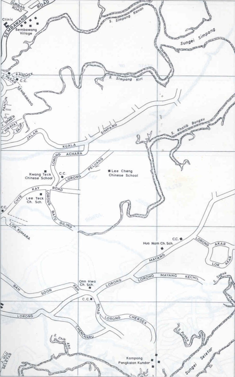
Simpang (Page Module:IPA/styles.css has no content.IPA: /ˈsɪmpʌŋ/ Script error: No such module "Respell".) is a planning area located in the North Region of Singapore. The word Simpang means junction or intersection in Malay. It is situated north of Yishun, east of Sembawang and west of Seletar. Pulau Seletar is classified under Simpang planning area. Jalan Kuala Simpang was the main road serving the area.[3] Sungei Simpang Kiri, Sungei Simpang Kanan and Simpang Kiri Park Connector retain and reflect the name of the area.
Simpang is currently a swamp area which is used by the Singapore Armed Forces as a training ground since the early 1996, after the plan of developing a "Simpang New Town" was rejected. In the original 1993 plan, the area was slated for 20,000 housing units in a low density. After the rejection and lull, there are plans for it to be converted into a high-density housing estate, it will be done in conjunction with the Seletar Line.
Simpang has four subzones for statistical and planning purposes: Pulau Seletar, Simpang North, Simpang South and Tanjong Irau.
References
Page Template:Reflist/styles.css has no content.
- ^ Page Module:Citation/CS1/styles.css has no content."Geographic Distribution Dashboard". Department of Statistics Singapore. June 2025. Archived from the original on 29 September 2025. Retrieved 7 October 2025.
- ^ Page Module:Citation/CS1/styles.css has no content."Six-digit postal codes will apply to all areas from Sept 1". The Straits Times. 19 August 1995. Retrieved 1 July 2025.
- ^ Page Module:Citation/CS1/styles.css has no content."1975, tile 117". OneMap Historical Map Viewer.
[[Category:Template:Resolve category redirect]]Template:Coord missing/CheckCat