Wisconsin Highway 24
Template:Short description Template:DMCA Template:DMCA
Page Template:Hlist/styles.css has no content.Page Template:Plainlist/styles.css has no content.Page Module:Infobox/styles.css has no content.Page Template:Infobox road/styles.css has no content.
| Script error: No such module "Infobox road/route". | |
|---|---|
| Lua error in package.lua at line 80: module 'Module:Road data/util' not found. | |
WIS 24 highlighted in red | |
| Script error: No such module "Infobox mapframe". | |
| Lua error in package.lua at line 80: module 'Module:Road data/util' not found. | |
| Lua error in package.lua at line 80: module 'Module:Road data/util' not found. | |
| Lua error in package.lua at line 80: module 'Module:Road data/util' not found. | |
| Lua error in package.lua at line 80: module 'Module:Road data/util' not found. | |
| Length | Lua error: expandTemplate: template "cvt" does not exist. |
| Existed | Lua error in package.lua at line 80: module 'Module:Road data/util' not found. |
| Lua error in package.lua at line 80: module 'Module:Road data/util' not found. | |
| Page Template:Plainlist/styles.css has no content.Page Module:Infobox/styles.css has no content.Major junctions | |
| West end | Template:Jct at Hales Corners border |
| |
| East end | Template:Jct in Milwaukee |
| Lua error: expandTemplate: template "Country name" does not exist. | |
| Lua error in package.lua at line 80: module 'Module:Road data/util' not found. | |
| Script error: No such module "Infobox road/browselinks". | |
| Lua error in package.lua at line 80: module 'Module:Road data/util' not found. | |
| Lua error in package.lua at line 80: module 'Module:Road data/util' not found. | |
Script error: No such module "Infobox road/errors".[[Category:Infobox road instances Template:Infobox road/meta/mask/category]]
State Trunk Highway 24 (often called Highway 24, STH-24 or WIS 24) is a 7.88-mile (12.68 km) state highway in southwestern Milwaukee County, Wisconsin, in the United States. The route is a multi-lane urban arterial that serves the suburbs of West Allis, Greenfield and Hales Corners, and follows Janesville Road and West Forest Home Avenue.
Route description
The highway's western terminus is at the Waukesha County line in Hales Corners. West of the county line the route is signed as County Trunk Highway L (CTH-L). The highway crosses 108th street, which carries U.S. Highway 45/Wisconsin Highway 100 (US 45/WIS 100), one mile (1.6 km) east of the county line. The section of WIS 24 between the county line and 108th Street is Janesville Road. The remainder of the highway follows West Forest Home Avenue.[2] East of US 45/WIS 100, the highway turns northeasterly, junctioning with Interstate 43/Interstate 894 (I-43/I-894) in Greenfield. Further northeast the route terminates at South 27th Street, which carries WIS 241.[3]
History
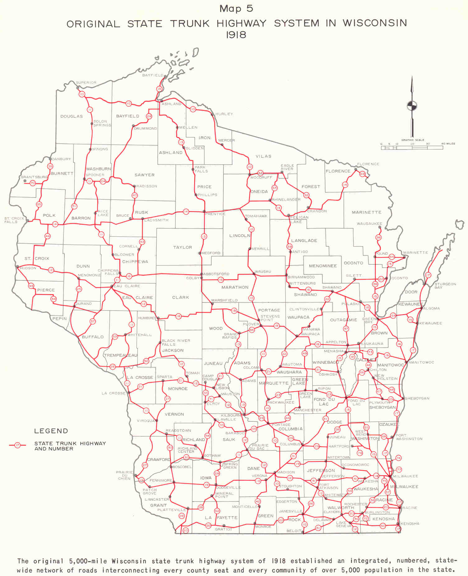
The original routing of WIS 24 in 1918 began in Washburn County began east of Spooner at then WIS 11 (the junction of CTH-M on WIS 70). The route junctioned with the former Wisconsin Highway 40 (now Wisconsin Highway 27) and turned northward, following what is now U.S. Route 63 (US 63) from Hayward to south of Ashland The highway followed what is now WIS 112 and terminated at WIS 13 south of Ashland.[4] The early 1920s saw WIS 24 extended southwestward along the present day route of US 63 to Turtle Lake then to New Richmond along WIS 64 and southwest to Hudson.[5] When US 63 was opened WIS 24 was removed from the books.[1]
WIS 24 used to continue southwest through Waukesha, Racine and Walworth Counties to Wisconsin Highway 20 in East Troy, but was turned over to local control and redesignated as CTH-L in the late 1980s.[1]
Major intersections
The entire route is in [[Milwaukee County, Template:Jct/statename|Milwaukee County]].
Script error: No such module "Jctint/USA". Script error: No such module "Jctint/USA". Script error: No such module "Jctint/USA". Script error: No such module "Jctint/USA". Script error: No such module "Jctint/USA". Script error: No such module "Jctint/USA". Script error: No such module "Jctint/USA".
| Location | mi | km | Destinations | Notes | |
|---|---|---|---|---|---|
| Page Module:Jctbtm/styles.css has no content.1.000 mi = 1.609 km; 1.000 km = 0.621 mi | |||||
See also
- Script error: No such module "portal-inline".
References
Page Template:Reflist/styles.css has no content.
- ^ a b c Page Module:Citation/CS1/styles.css has no content.Bessert, Chris. "Highways 20-29 (Highway 24)". Wisconsin Highways. Retrieved March 20, 2007.[self-published source]
- ^ Template:Google maps
- ^ Page Module:Citation/CS1/styles.css has no content.Milwaukee Co (PDF) (Map). Wisconsin Department of Transportation. Retrieved January 10, 2008.
- ^ Page Module:Citation/CS1/styles.css has no content.Bauer, Kurt W. (March 1969). "Map 5: Original State Trunk Highway System in Wisconsin 1918" (Map). A Jurisdictional Highway System Plan For Milwaukee County. Southeast Wisconsin Regional Planning Commission. Retrieved January 10, 2008 – via Midwest Roads.
- ^ Page Module:Citation/CS1/styles.css has no content."Rand McNally Auto Road Atlas". Rand McNally. 1926. Archived from the original on March 31, 2008. Retrieved January 10, 2007.
External links
Script error: No such module "Attached KML".
- Page Template:Sister-inline/styles.css has no content.Script error: No such module "Sister project logo". Media related to Script error: No such module "Commons link". at Wikimedia Commons



.jpg)