Wisconsin Highway 25
Template:Short description Template:DMCA Template:DMCA
Page Template:Hlist/styles.css has no content.Page Template:Plainlist/styles.css has no content.Page Module:Infobox/styles.css has no content.Page Template:Infobox road/styles.css has no content.
| Script error: No such module "Infobox road/route". | |
|---|---|
| Lua error in package.lua at line 80: module 'Module:Road data/util' not found. | |
WIS 25 highlighted in red | |
| Script error: No such module "Infobox mapframe". | |
| Lua error in package.lua at line 80: module 'Module:Road data/util' not found. | |
| Lua error in package.lua at line 80: module 'Module:Road data/util' not found. | |
| Lua error in package.lua at line 80: module 'Module:Road data/util' not found. | |
| Lua error in package.lua at line 80: module 'Module:Road data/util' not found. | |
| Length | Lua error: expandTemplate: template "cvt" does not exist. |
| Existed | Lua error in package.lua at line 80: module 'Module:Road data/util' not found. |
| Lua error in package.lua at line 80: module 'Module:Road data/util' not found. | |
| Page Template:Plainlist/styles.css has no content.Page Module:Infobox/styles.css has no content.Major junctions | |
| South end | Template:Jct in Nelson |
| |
| North end | Template:Jct in Rice Lake |
| Lua error: expandTemplate: template "Country name" does not exist. | |
| Lua error in package.lua at line 80: module 'Module:Road data/util' not found. | |
| Script error: No such module "Infobox road/browselinks". | |
| Lua error in package.lua at line 80: module 'Module:Road data/util' not found. | |
| Lua error in package.lua at line 80: module 'Module:Road data/util' not found. | |
Script error: No such module "Infobox road/errors".[[Category:Infobox road instances Template:Infobox road/meta/mask/category]]
State Trunk Highway 25 (often called Highway 25, STH-25 or WIS 25) is a state highway in the US state of Wisconsin. The highway serves local traffic in the western part of the state, connecting Durand, Menomonie and Barron. It is two-lane surface road with the exception of urban multilanes within Menomonie.
Route description
WIS 25 begins at the Minnesota state line in Buffalo County on the Mississippi River. The route enters the state from Trunk Highway 60. WIS 25 briefly follows WIS 35 north in Nelson then follows the Chippewa River, passing through Maxville and entering Pepin County.[2] After about three miles (4.8 km), WIS 25 enters Durand and joins US 10 west. After two miles (3.2 km) of concurrency, WIS 25 turns off northeast and enters Dunn County four miles (6.4 km) northeast.[3]
WIS 25 junctions with WIS 72 in Downsville six miles (9.7 km) north of the county line. After another seven miles (11 km), WIS 25 enters Menomonie, junctions with WIS 29 near the University of Wisconsin–Stout campus and joins US 12 in the downtown area near Lake Menomin. WIS 25 splits from US 12 after a one-mile (1.6 km) concurrency with US 12 turning northwest. WIS 25 interchanges with I-94 one-half mile north of the US 12 turnoff. After a ten-mile (16 km) segment, the highway crosses WIS 170 in Wheeler. About five miles (8.0 km) north of Wheeler, WIS 25 joins WIS 64 east for one mile (1.6 km) before turning north again. The highway passes through Ridgeland on the Barron County line.[4] WIS 25 passes west of Dallas, and through the small community of Hillsdale before entering Barron thirteen miles (21 km) north of the county line. The highway crosses US 8 in Barron. WIS 25 terminates at WIS 48 seven miles (11 km) north of Barron, or five miles (8.0 km) east of Rice Lake[5]
History
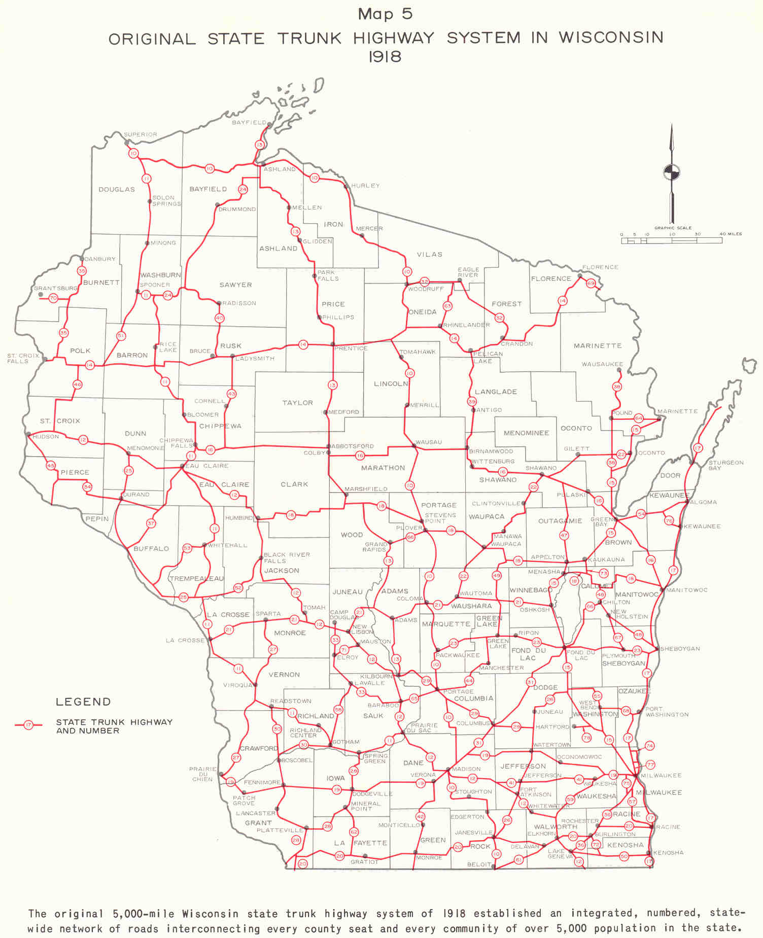
The original alignment of WIS 25 was along the present-day route from Nelson to Menomonie. From Nelson southward, WIS 25 followed the routing of present-day WIS 35 to junction with then WIS 52 at Galesville.[6] The route was truncated at Durand in the early 1920s and also extended to end at then WIS 14 (present day US 8) and to WIS 48 a few years later.[1][7] The route was extended again to Nelson when WIS 35 was rerouted across a new bridge over the Chippewa River in 1933. Finally in 1947, The route was extended through Nelson and across the Mississippi River and connected to MN 60.
Major intersections
Script error: No such module "Jctint/USA". Script error: No such module "Jctint/USA". Script error: No such module "Jctint/USA". Script error: No such module "Jctint/USA". Script error: No such module "Jctint/USA". Script error: No such module "Jctint/USA". Script error: No such module "Jctint/USA". Script error: No such module "Jctint/USA". Script error: No such module "Jctint/USA". Script error: No such module "Jctint/USA". Script error: No such module "Jctint/USA". Script error: No such module "Jctint/USA". Script error: No such module "Jctint/USA". Script error: No such module "Jctint/USA". Script error: No such module "Jctint/USA". Script error: No such module "Jctint/USA". Script error: No such module "Jctint/USA". Script error: No such module "Jctint/USA". Script error: No such module "Jctint/USA".
| County | Location | mi | km | Destinations | Notes |
|---|---|---|---|---|---|
| Page Module:Jctbtm/styles.css has no content.1.000 mi = 1.609 km; 1.000 km = 0.621 mi Page Template:Hlist/styles.css has no content.
| |||||
See also
- Script error: No such module "portal-inline".
References
Page Template:Reflist/styles.css has no content.
- ^ a b Page Module:Citation/CS1/styles.css has no content.Bessert, Chris. "Highways 20–29". Wisconsin Highways. Archived from the original on December 14, 2007. Retrieved March 20, 2007.[self-published source]
- ^ Page Module:Citation/CS1/styles.css has no content.Wisconsin Department of Transportation (2006). Buffalo Co. (PDF) (Map). 1:100,000. Madison: Wisconsin Department of Transportation. Archived from the original (PDF) on May 16, 2008. Retrieved January 12, 2008.
- ^ Page Module:Citation/CS1/styles.css has no content.Wisconsin Department of Transportation (2006). Pepin Co. (PDF) (Map). 1:100,000. Madison: Wisconsin Department of Transportation. Archived from the original (PDF) on May 16, 2008. Retrieved January 12, 2008.
- ^ Page Module:Citation/CS1/styles.css has no content.Wisconsin Department of Transportation (2006). Dunn Co. (PDF) (Map). 1:100,000. Madison: Wisconsin Department of Transportation. Archived from the original (PDF) on October 30, 2014. Retrieved January 12, 2008.
- ^ Page Module:Citation/CS1/styles.css has no content.Wisconsin Department of Transportation (2006). Barron Co. (PDF) (Map). 1:100,000. Madison: Wisconsin Department of Transportation. Archived from the original (PDF) on May 16, 2008. Retrieved January 12, 2008.
- ^ Page Module:Citation/CS1/styles.css has no content.Bauer, Kurt W. (March 1969). "Map 5: Original State Trunk Highway System in Wisconsin 1918" (Map). A Jurisdictional Highway System Plan For Milwaukee County. Southeast Wisconsin Regional Planning Commission. Retrieved January 10, 2008 – via Midwest Roads.
- ^ Page Module:Citation/CS1/styles.css has no content.Rand McNally and Company (1926). "Wisconsin (Northern)" (Map). Rand McNally Auto Road Atlas. Chicago: Rand McNally. Retrieved January 10, 2007.[full citation needed]
External links
Script error: No such module "Attached KML".
- Page Template:Sister-inline/styles.css has no content.Script error: No such module "Sister project logo". Media related to Script error: No such module "Commons link". at Wikimedia Commons